DIGITAL
TWIN
Virtual or digital representation on a map of a real or potential object in Russia and the CIS
Advantages of the digital twin
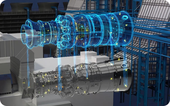
A digital twin is a virtual or digital representation on a map of a real or potential object. It is created for buildings, structures, industries and agricultural enterprises and any other necessary facilities.
Possibility of integration
Possibility of integration with existing platforms.
Design schemes
Simulate various design concepts to evaluate efficiency and functionality.
Delegation of assignments
Access control, setting up rights and roles, collaboration between project teams.

Solutions enabled by a digital twin
Conduct a quick and low-cost test run of a process or production chain.
Detect problems or vulnerabilities before production starts or an asset goes into operation.
Improve the efficiency of processes or systems by tracking all disruptions before the start.
Build long-term forecasts and plan product development.
Layers of the digital twin
A digital twin consists of several layers, each of which provides a specific set of functions and data.
Lighting networks
- Detailed information on each support, control cabinet, lamp or power line
- Quick access to instructions and equipment data sheets.
- Monitoring warranty and maintenance periods.
Water supply
- Displaying the sewerage and water supply system on the map (external and underground lines)
- Distribution of the city on the map by operational areas
- Design mode - creating a circuit at the design stage
- Displaying repair work on the map
Forest belts
- Displaying the forest belt system on the map
- Design mode - creating a circuit at the design stage
- Possibility of quick attachment of documentation to the object card
- Quick access to the characteristics of each site
Heating networks
- Displaying all heating networks on the system map
- Design mode - creating a circuit at the design stage
- Possibility of quick attachment of documentation to the object card
- Quick access to technical characteristics of each pipeline section: diameter, length, material
Reservoirs
- Displaying on a map the system of all water bodies of a given territory
- Display information about the owner or tenant of the site
- Design mode - creating a circuit at the design stage
- Display of the area of a water body, hydraulic connection, objects in a water body
Agricultural fields
- Displaying on a map the system of all agricultural fields of a given territory
- Display information about the owner or tenant of the site
- Possibility of quick attachment of documentation to the object card
- Displaying the area of the cultivated field
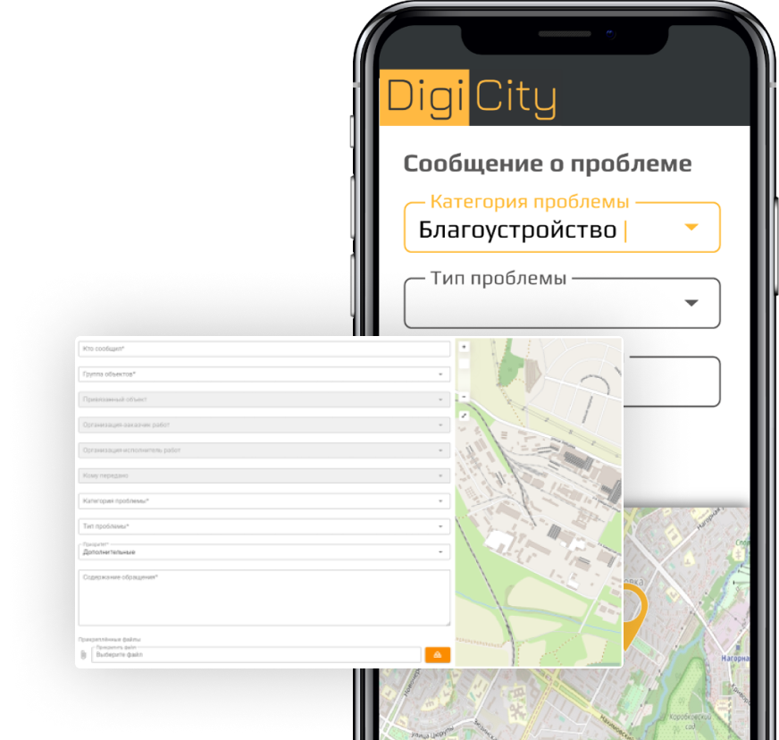
Module of Citizen Reporting
The module allows residents to promptly report city life issues related to housing and communal services (ЖКХ), public amenities, urban infrastructure (parking, transport, parks, etc.), and any others.
Opportunities
- Problems can be reported via a public link or QR code.
or a convenient mobile application. - The dispatcher processes incoming requests, assigns them to departments, and designates responsible individuals for task completion.
and execution deadlines. - All received requests are compiled into an accessible log.
- Key features include a convenient filter, the option to view requests by date range, and color-coded status tracking.
- A one-time export of request reports is also available.
as well as a subscription for its periodic receipt.
Main Components of the digital twin
Physical object
The real object, process, or system for which the digital twin is created.
Sensors and data
Devices that collect data on the state of the physical object and transmit it to the digital twin (temperature, pressure, vibration, coordinates, images, etc.).

Information model
A structured representation of data describing the physical object and its environment.
Analytical platform
Tools for data analysis, behavior modeling, scenario simulation, and outcome prediction.

Stages of the digital twin
- Modeling the digital copy of the object.
- Model implementation.
- Testing core operational processes on the digital twin.
- Launch and setup.
- Adjustment and development of the original object or system.
Display of the digital twin
Visual representation of digital twin layers in the DigiCity system.

- Detailed information on each support, control cabinet, lamp or power line
- Quick access to instructions and equipment passport
- Monitoring warranty and maintenance periods

- Displaying all heating networks on the system map
- Design mode - creating a circuit at the design stage
- Possibility of quick attachment of documentation to the object card
- Quick access to technical characteristics of each pipeline section: diameter, length, material

- Displaying the sewerage and water supply system on the map (external and underground lines)
- Distribution of the city on the map by operational areas
- Design mode - creating a circuit at the design stage
- Displaying repair work on the map

- Displaying on a map the system of all agricultural fields of a given territory
- Display information about the owner or tenant of the site
- Possibility of quick attachment of documentation to the object card
- Displaying the area of the cultivated field

- Displaying on a map the system of all water bodies of a given territory
- Display information about the owner or tenant of the site
- Design mode - creating a circuit at the design stage
- Display of the area of a water body, hydraulic connection, objects in a water body

- Displaying the forest belt system on the map
- Design mode - creating a circuit at the design stage
- Possibility of quick attachment of documentation to the object card
- Quick access to the characteristics of each site
Take a look at our presentation.
Find out more about digital twins from our
PDF-presentations


