DigiCity
Universal DigiCity software, , created for managing services and monitoring systems of a smart city
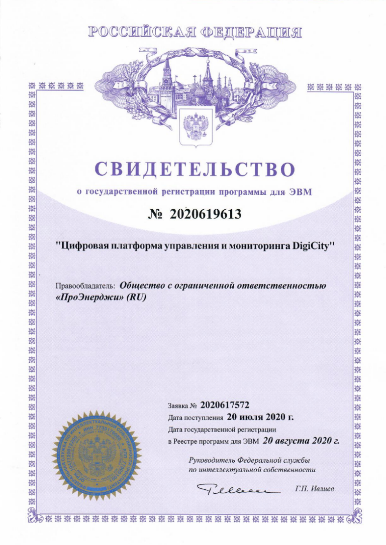
The services include an Automated outdoor lighting control system, an Automated electricity control and Metering system, Waste monitoring, Pedestrian crossing management, a Smart Support complex, a Digital Twin, a Smart Enterprise, etc. Digital management and monitoring platform DigiCity The digital management and monitoring platform DigiCity has been included in the Register of Russian Software.
BUDGET SAVINGS
Saving electricity
USE DIGICITY
Large user reach
COMPLETED PROJECTS
Many satisfied customers
PARTNERS
Working with famous brands
Components of DigiCity
We present the main modules that make up the system.
Smart Lighting
The system allows you to automatically adjust lighting modes according to weather conditions and other parameters by dimming.
Control cabinets
Control cabinets allow you to manage lighting, pump systems, and other equipment, ensuring their efficient and safe operation.
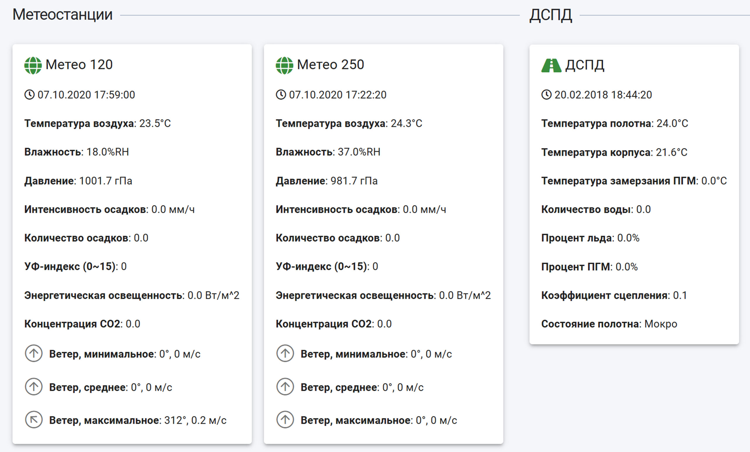
Meteorological analytics
Thanks to built-in sensors, they monitor air temperature, humidity levels, pressure, rainfall, and other parameters.
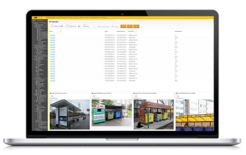
Smart trash bins
The universal fill sensor allows you to monitor the fillability of various containers.
Smart lighting module
- Detailed information about each lamp or power line.
- Tracking the readings of meters and devices.
- Quick access to instructions and equipment data sheets.
Control cabinets
- Detailed information for all cabinets.
- Diagrams of various cabinet statuses
- Tracking of instrument readings.

Meteorological analytics
- Detailed information according to weather stations
- Tracking of instrument readings.
- Quick access to instructions and equipment data sheets.
Smart trash bins
- Detailed information for each bins.
- Tracking the readings of meters and devices.
- Quick access to instructions and equipment data sheets.
Display and monitoring on the map of objects
Various spheres of housing and communal services
Lighting networks
- Detailed information on each support, control cabinet, lamp or power line
- Quick access to instructions and equipment data sheets.
- Monitoring warranty and maintenance periods.
Water supply
- Displaying the sewerage and water supply system on the map (external and underground lines)
- Distribution of the city on the map by operational areas
- Design mode - creating a circuit at the design stage
- Displaying repair work on the map
Forest belts
- Displaying the forest belt system on the map
- Design mode - creating a circuit at the design stage
- Possibility of quick attachment of documentation to the object card
- Quick access to the characteristics of each site


Other objects
Heating networks
- Displaying all heating networks on the system map
- Design mode - creating a circuit at the design stage
- Possibility of quick attachment of documentation to the object card
- Quick access to technical characteristics of each pipeline section: diameter, length, material
Reservoirs
- Displaying on a map the system of all water bodies of a given territory
- Display information about the owner or tenant of the site
- Design mode - creating a circuit at the design stage
- Display of the area of a water body, hydraulic connection, objects in a water body
Agricultural fields
- Displaying on a map the system of all agricultural fields of a given territory
- Display information about the owner or tenant of the site
- Possibility of quick attachment of documentation to the object card
- Displaying the area of the cultivated field
Are there no necessary modules in our software?
We will design them for you!
Description of the technology stack
List of all technology services used to create and operate the DigiCity application:
Programming languages:
— PHP, JavaScript, Go, Typescript.
Frameworks:
— Vue.js, Сodeigniter.
DB, DBMS:
— PostgreSQL, Redis.
Version control systems:
— Git, Gitlab.
Server and cloud infrastructure:
— Docker, Docker Compose, Nginx, PHP-FPM.
Documentation DigiCity platform
The software cost is determined on request,depending
on the requested characteristics.
To receive a commercial offer, please send us an email: office@digicity.io
Download documentation:
Leave your request
Learn more about the DigiCity Cloud Platform in our
PDF presentation